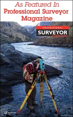
 In the early 1990s GPS was a new and amazing, even if a seldom-used technology. Although the military had been using GPS for over a decade, civilian surveyors were skeptical of its necessity when non-electronic hand tools had sufficed since the beginning of their profession.However, it became apparent that the benefits of GPS were such an enormous boon that its use slowly gained acceptance over the years until today it is ubiquitous for all surveying projects. Using GPS to provide static measurements of control points for places and structures is now the norm.
2D Plans Shift to 3D Models
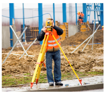
Today, in much the same way another revolutionary technology is challenging the surveyor’s world of two-dimensional flat drawings and blueprints of buildings, bridges, and landscapes. Three-dimensional large-scale laser scanning has been making inroads for over 10 years, but the paradigm shift is still in the works. Surveyors are familiar with the concept, with the principles of 3D laser scanning, but not necessarily with the practice. However, as access to 3D large-scale laser scanning, or terrestrial laser scanning, becomes widespread, its benefits will become obvious to more and more surveying professionals. Even though the majority of surveying firms are comfortable with AutoCAD and MicroStation software in 2D, the 3D worldview is often the missing piece of the puzzle. Eventually, however, surveyors will certainly come to a point when they will ask themselves, “how did we make do in the 2D universe for so long and why?”
 Today large-scale 3D laser scanning is a viable alternative for surveying sites and structures like never before. Steve DeRemer, General Manager of Laser Design Inspection Services- Michigan, a global provider of dimensional measurement and terrestrial laser scanning services, has noted a marked increase of customers for terrestrial laser scanning services. He stated, “Civil engineers like the idea of being able to laser scan large project areas and achieve highly accurate 3D models. However, they are still apprehensive about their capabilities to perform the scans and handle the voluminous amount of data that is generated. Laser Design is a full-service 3D scanning company with experience in helping others gain entrée into the field successfully with our consulting, training, and data processing services. With its quarter century in the 3D business, Laser Design has the experience and many software packages to provide the results the customer needs.”
Three-dimensional laser scanning first appeared on the scene in the 1980s. Again, the military was one it its first adopters. In those days, laser scanning was done point by point, so it was a labor-intensive and time-consuming measurement method. The technology quickly improved, leading to the invention of line-lasers and software that allowed collecting thousands of points per second. Accuracies also improved exponentially.
Industrial engineers cautiously jumped on the bandwagon as they saw a fast, accurate way to reverse engineer models and prototypes and to inspect manufactured parts. They were able to design products using computer-aided design (CAD) software programs, and 3D CAD models became fully integrated into the design and manufacturing proces. Although work envelopes of laser scanning systems could be constructed to accommodate large industrial objects, the technology was still advancing to the point where it could three-dimensionally scan large-scale structures and environments.
Applications of 3D Terrestrial Laser Scanning
 Terrestrial laser scanning is a valid application for surveying large-scale, complex entities, such as entire buildings, factories, power plants, roads, bridges,landscapes, and other structures and locations. The collected data can be used to create universally usable, dimensionally accurate 3D CAD models orconventional 2D line drawings such as blueprints or floor plans.
Site Planning
One of the most prevalent applications of terrestrial laser scanning is in scanning the complex exteriors of extremely large structures such as industrial plants and refineries. The 3D models can help determine the volume of work required and map out new and retrofit installations. Civil engineers can use laser scanning to digitize existing and proposed locations for roadways and bridges. With the exact topographical features, they can calculate how much material must be moved, where the best contours are, and many other aspects of infrastructure construction. Sometimes when the blueprints of a structure are missing or outdated, the terrestrial laser scanner can produce data that accurately represents the structure in 3D before any construction, demolition, or re-construction is started. Having site documentation from scan data that is extremely accurate makes planning building and infrastructure updates much easier and less expensive.
When the area to be scanned is larger than the laser’s field of view, using registration spheres to allow multiple scan positions increases the scanning volume and layouts that can be digitized. Case in point, four exterior sides of a building cannot be digitized from one scanner position due to line of sight, but through the use of reference spheres, data from all four sides of the building can be related back together to form one complete 3D scan.
Inspection
 As-built inspection is a popular application of terrestrial laser scanning that is proving to be timesaving and very cost effective. The speed of data collection is 100 times faster than conventional scanners, collecting 8 megapixels of data in less than one minute, so even the largest scan scenario is time efficient. Scene specific 3D measurements can be made directly from the 3D scan data. Non-contact laser scanning means that no detail is omitted or disturbed, which is essential when documenting as- built structures for safety or environments to be developed.
During the execution of the construction project, terrestrial laser scanning can be used to perform inspection of the work at various intervals, making sure that the plans are accurately executed. It can uncover design flaws before they become costly and time consuming by providing complete and accurate dimensional measurements of the current project status. At the end of the project, a final scan or model can serve as archive data of the size and layout of the structure at a given point. This information can prove invaluable during subsequent renovations or repairs.
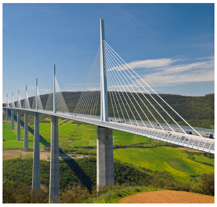
An as-built inspection application that has come into prominence lately is the inspection of bridges. Currently, most bridge inspections are done using still photographs. Someone must climb up on the bridge’s underside to get close enough to take pictures, in the hopes of documenting as much of the structure as possible. Obviously, two-dimensional pictures of three-dimensional objects only show obvious problems that are visible at a certain distance. They cannot reveal hidden damage or changes in size or position like actual measurements. Irregularities, for example anomalies in the depth of surfaces or changes in depth over time, cannot be clearly defined. In contrast, 3D scan data from abridge can be archived, and data from subsequent scans can be overlaid to plainly show differences in the structure.
Logistically, getting up close to a bridge’s infras tructure is also a problem. Traffic, climate, height, and many more factors make getting hands-on measurements hazardous to humans. Terrestrial laser scanning provides highly accurate 3D measurements of bridge supports from a safe vantage point. The entire structure can be examined, not just land mark measurements, by repositioning the laser scanner as needed. Areas of interest can be identified from the scan files for further examination, saving time and keeping people out of harm’s way. The amount, quality, and completeness of the information obtained are far more than any number of photographs could provide.
Urban Renewal and Planning
Terrestrial laser scanning can even play a major role in revitalizing and improving neighborhoods through better planning of urban renewal. Cities have come to see the value in beautifying their central residential and green areas. To create a coherent design, entire blocks or parks can be laser scanned to provide accurate topographical information to architects and city planners. 3D scanning gathers infinitely more information than photographs or blueprints in terms of the current “lay of the land,” for example where structures and landmarks are, sizes and volumes of areas, even natural elements such as trees and hills.
The true-to-life scans can be used to design new features, calculate renovations to old, and create a totally accurate model in three dimensions which is easier for the public and government officials to visualize. High-speed terrestrial laser scanners can survey the site quickly and more inexpensively than manual survey techniques, making the cost estimating process of the project more accurate, faster, and of better quality as the risk of execution goes down. Better documentation and improved visualization means a quicker, less expensive approval process as well.
Professional Services for Terrestrial Laser Scanning
As with any complex technology, terrestrial laser scanning requires specialized equipment, software, and training to obtain optimal results. “Many of these large-scale scanning applications are one-time projects where the customer can’t justify the substantial cost of buying and learning a new system and its software,” commented DeRemer of Laser Design Inspection Services. “As experts in all forms of digitizing, Laser Design can provide a more cost effective solution in the form of rental equipment and highly experienced personnel to run it or to thoroughly train others to run it. This usually costs less than buying the equipment outright.”
Capital outlay for specialized applications may be large compared to what most surveyors and engineers are used to paying for equipment and software packages. Whereas typical surveying equipment and software may be in the range of $5,000 to $25,000, laser scanning systems can be more than double that amount, which is why renting makes sense for occasional projects.
However, DeRemer cautions, “Oftentimes when a complex technology is first used by a novice, the results are not always ideal. Experience is the best teacher, so when a customer rents from us, we do not skimp on training them in all the intricacies of the system and software.” When the right system and software are used, and when the scan is performed optimally, the excellent results speak for themselves, and many service customers eventually become system owners.
Some forward-thinking companies have even purchasedseveral systems because they perform several specialized applications. “Using the right tools for the job, and using them correctly, makes all the difference between a project’s success and a disappointed customer,” continued DeRemer. “If a customer wants to do a test scan, we make sure a professional shows them the real capabilities and real results of the terrestrial scanning system. Making due with outdated equipment and technologies is not the way to earn business in the current marketplace.”
Another significant learning curve in terrestrial laser scanning is post-processing the huge data files into a usable format. Three-dimensional laser scanning gathers almost infinitely more information than traditional measurement methods. The entire scenario is captured, not just specific reference points. Depending on what will be done with the data, various types of deliverables may be required. “Laser Design offers data post-processing of terrestrial scanning data,” DeRemer noted. “Each application is best served with a certain software package, and we have many of them at our disposal.
Even customers who perform their own scans can send us their data for editing into the format they need. With the high cost of buying some software packages, having Laser Design perform this step can also save money and time.” Depending on the need, the raw point cloud data can be exported into a variety of formats, including ASCII, DXF, DWG, IGES, and STEP. The raw scan data can also be optionally post-processed into many other deliverable data file formats including AutoCAD, SolidWorks, Pro/ENGINEER, CATIA, UG, IDEAS, and more.
Enduring Benefits of Terrestrial Laser Scanning
Surveyors have traditionally been very hands-on people and are not used to having to deal with support staff and complicated technologies. The time has come, however, to embrace the three-dimensional world and its technologies as an enormous boon to the profession. The surveying worldis no longer flat. In order to satisfy clients who are increasingly sophisticated technically and demanding ever-faster turnaround times, high-speed 3D terrestrial laser scanning will soon become indispensible. The business case is compelling for providing clients with detailed, real-life three- dimensional models, because it allows accurate and consistent visualization of the project scope and details. Costs and scheduling can be estimated more accurately and the process takes less time to complete. The risk of unknown variables diminishes, so the quality of the work improves.
The challenge for surveyors and civil engineers in the 21st century is to move forward into the realm of three-dimensional laser scanning, knowing that the benefits of time and money saved, accuracy, ongoing quality control, and human safety will far outweigh the drawbacks and fear of the unknown. Experienced professionals can make the transition smooth and seamless with their wealth of logistical knowledge and data processing experience. Their goal is to make sure the civil engineering profession can apply all the advantages of the terrestrial laser scanning technology to satisfy their very demanding customers—the public.